الموقع ثم الموقع ثم الموقع!: لماذا يعد استخدام نظم المعلومات الجغرافية في مشاريع التنمية الريفية أمرًا أساسيًا
Location, location, location: Why using GIS in rural development projects is fundamental


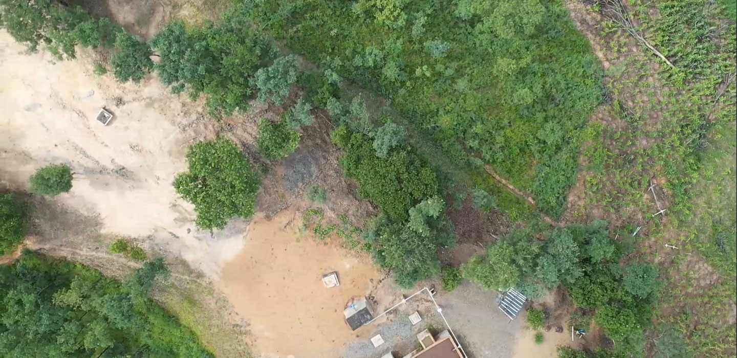
©️IFAD/Mawira Chitima - one location of the IFAD-supported Programme for Rural Irrigation Development in Malawi (February 2020)
Think, for a second, about the geographic location where you live – or where your loved ones live. If an emergency were to occur near that location, you would quickly check if everything is okay. Knowing the geographic location of people or things that are dear to us is unquestionably important. It helps us to monitor well-being and assess the impact of an event that happened at or near that location.
Likewise, knowing exactly where IFAD-supported projects take place, and what the conditions are on the ground, is fundamental to our business operations.
Thanks to the increasing availability of geographic information system (GIS) technologies, we now have more tools than ever to help us design and implement our projects. GIS allows us to pinpoint the location of our beneficiary groups on a map, even in highly remote areas. It helps us design projects better, thanks to the precise data on the locations and landscapes of our planned project areas. It can also inform decision-making during implementation and monitor current conditions, even without a supervision mission – thus potentially saving costs and travel time. Because these data are so easily accessible, we can also supervise more frequently and more broadly, allowing us to say with confidence how well a project is faring over time.
Just like natural geographic features, all man-made construction – such as road and irrigation infrastructure, farmers’ fields, warehouses, market sites and other buildings –is visible from the sky. Once the location of any one of these assets has been geo-referenced, i.e. its precise GPS coordinates have been collected on location, we can use satellite or aerial images to view them and track them over time. Not only that, we can measure them accurately: for example, taking an exact measurement of a plot of farmland will allow us to measure its future agricultural yields more precisely. In a sense, we do not always have to ground-truth things: we can now “space-truth” them.
GIS technologies are already in use in several IFAD projects. The BIRDP project in Sudan, for instance, used geographically referenced data to plan its reforestation and afforestation activities. Using a clearly mapped picture of the project area’s landscape, the project team calculated the number of tractors, seeds and seedlings that would be needed, on the basis of the area to be covered and the survival rates of tree seedlings. The team also used data on slopes and rainfall patterns, linked to the GPS coordinates that had been collected, to determine the number of water-harvesting structures that would need to be built.
In Uganda, the PRELNOR project geo-referenced the road infrastructure that it constructed. With these data, IFAD can now measure the effect of these investments on beneficiaries’ access to agricultural markets. Moreover, it will be possible to assess the sustainability of these investments and impacts far into the future – 10, 15 and even 20 years from now!
The monitoring and evaluation team for Sierra Leone’s Smallholder Commercialisation Project geo-referenced project sites, including inland valley swamps where intensive rice production was promoted. As a result, the authors of this blog have been able to link the GPS coordinates of the developed swamps with remote sensing data on rainfall, temperature, land cover and fires. Geospatial and statistical analysis of the data reveals that the project has reduced fire occurrences by 2.8 fires per year within the developed swamp areas and a surrounding buffer zone.
The impact assessment for Bolivia’s ACCESOS project entails geo-referencing the target and comparison households, as well as measuring farmland areas, using GPS devices. Collecting the GPS coordinates will allow us to enrich the analysis of household survey data, collected as part of the impact assessment, by linking it with climatic remote sensing databases. In addition, GIS devices are being used for precise measurement of land areas, which will be crucial in assessing agricultural yields.
Meanwhile, a programme in India dedicated to redeveloping communities after the 2004 tsunami has geo-referenced the locations of the artificial reefs that were put in place. These GPS coordinates are being merged with datasets on sea surface temperature and cyclone landfall to help assess fish diversity and fishing productivity in the area and to monitor these communities’ resilience to cyclones.
Thanks to the numerous satellites that have been launched into space as well as aerial instruments such as drones, radar and airplanes, billions of pictures of the earth are constantly being captured from above. These images facilitate a variety of GIS-based big data analytics that have great potential to enhance IFAD projects. The use of GIS in rural development projects will only become more and more powerful, furthering our progress towards the SDGs – and in this case, the sky is no limit.
تاريخ النشر: 03 يوليو 2020