Fighting fires with rice paddies in Sierra Leone
Fighting fires with rice paddies in Sierra Leone


 © IFAD/Oliver Mundy
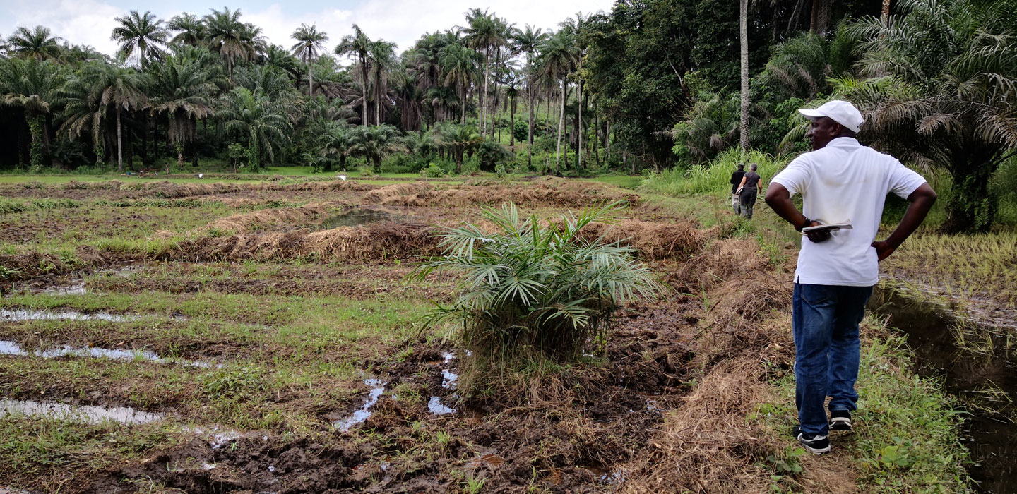
Farmers in Sierra Leone have shifted from slash-and-burn cultivation to rice cultivation in inland swamps. That is reducing the number of forest fires, a GIS study has shown.
The IFAD-supported Smallholder Commercialization Programme has helped nearly 150 farmer groups throughout Sierra Leone improve their wetland rice cultivation practices. The programme has introduced low-cost irrigation systems in swamps located in valleys, creating canals and bunds that allow farmers to channel and divert water to where it is needed and prevent rice seedlings from being washed away during heavy downpours.
This practice allows rice and other crops to be cultivated three times per year as opposed to just once – and these higher yields bring about gains in income and food security for the farmers.
Improving wetland rice cultivation in valleys also has an additional unexpected benefit. As a new study has shown, the development of rice paddy fields is reducing the number of forest fires in the surrounding areas.
Many of the farmers in the programme are now focusing more on wetland rice cultivation and are practicing less slash-and-burn cultivation. This latter method involves clearing a patch of land in the forest, usually by using fire, to make room for rice and other crops. Farmers cultivate the land for several years until the soil fertility declines, then move on to another area. This practice comes with several disadvantages: crop yields are often low, and they come at great cost to the local environment.
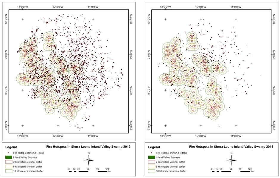 |
| Images showing the decrease in annual fires around surveyed swamps between 2012 (left) and 2018 (right). |
IFAD staff had been hearing from local programme staff and from the farmers themselves that local farmers were taking up wetland cultivation instead of using the slash-and-burn practices. During the final project mission in 2019, they decided to investigate further. In particular, IFAD staff working on a project aiming to integrate GIS into the agency’s monitoring efforts realized that the shifts in practice made by these farmers might be enough to produce results visible from space.
They were right.
Thanks to the thorough coordinate mapping carried out by the programme staff, IFAD’s GeoM&E team were able to compare swamps developed by the programme with other swamps that remained undeveloped. They overlaid the data onto a dataset from NASA’s Fire Information for Resource Management System (FIRMS).
There were on average 2.8 fewer fires a year within 10 km of the rice paddies developed by the programme, equal to a reduction of over 60 per cent during the duration of the project.
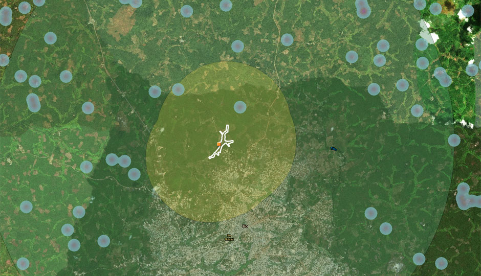 |
| This image shows the locations of fires (purple and blue dots) compared with a swamp developed by the programme (white). In this case, there were two fires within a 2-km radius of this swamp. |
GIS and econometric analysis showed that there were an average of 1.0 fewer fires within a 5-kilometre radius and 0.3 fewer fires within 2 kilometres. These measurements remained the same after controlling for other possible confounding factors, including precipitation, temperature, degree of slope incline, and road infrastructure. All results had a p-value of 0.001, meaning they were statistically significant (i.e., extremely unlikely to have occurred due to random chance).
This analysis was only possible because the local programme staff rigorously collected GPS coordinates on the swamps as part of their efforts to plan, track progress, and report on outcomes. All told, they mapped over 3,281 hectares of swamp, of which 1,411 hectares were ultimately developed.
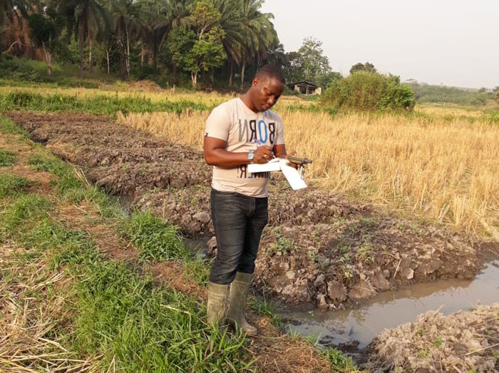 |
| A programme staff member collects the GPS coordinates of a paddy. © Smallholder Commercialization |
The programme had not anticipated that developing the swamps would lead to fewer fires. These results indicate that valley development of the kind undertaken in this programme has positive effects for both farmers and the environment. They also suggest that the valley development model could be replicated elsewhere in Sierra Leone. Indeed, preliminary efforts are already under way thanks to a new IFAD-supported project in the country.
The success of this study is also confirmation that collecting and tracking GPS coordinates of project activities is a useful management tool – and that new insights can be gained by comparing project locations with external datasets.
Acknowledgements
This study was funded by IFAD’s Innovation Challenge programme. The authors would like to thank Abu Bakar Sidique Bangura, GIS Officer, and the rest of the Smallholder Commercialization Programme team for contributing the information presented here.
Learn more about IFAD's work in Sierra Leone.
Publication date: 07 April 2021